 AZ
AZ EN
EN RU
RU
ADVENTURE OF THE PORTUGUESE MARINE TRAVELLING TO INDIA IN THE ATLANTIC OCEAN - PART I
Most scientists, even the most famous scientists of geography, history of geographical discoveries and history accepted geographical discoveries without investigating some events concerning concrete discovery and such discoveries went down in history as “casual discoveries”. “Casual” discovery of Brazil is obvious case of it.
They explained it as following: two strong currents moving towards west and northeast current existing on the territory between 100 north latitude and 100 south longitude. So vessels might sail to Brazilian coasts involuntarily under the influence of those natural calamities. Was such mistake possible, if Bartolommeo Dias, who could sail from Portugal to the south outskirts of Africa, participated in the expedition? Of course, it wasn’t possible! If such serious mistake was made with participation of Dias, who knew eastern coasts of the Atlantic Ocean very well, how he could reach the Cape of Good Hope located at 10 thousand km away from Lisbon? So questions appear in accordance with that enigmatic discovery. One of main questions: might Pedro Cabral make that mistake and change the course according to the secret task of the king of Portugal Manuel I? 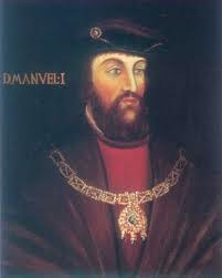 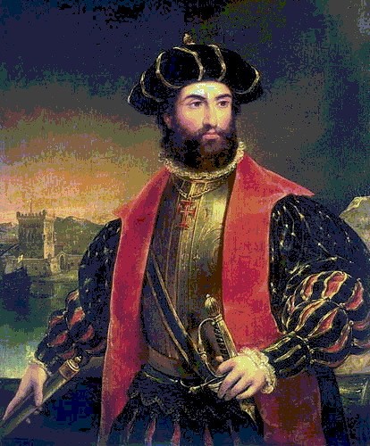 King of Portugal Manuel I (1469-1521) Vasco da Gama (1460-1524) Scientists, who support the idea of “casual discovery”, note that three strong currents existed in the middle of the Atlantic Ocean when Pedro Cabral sailed to the south. They write that, he had reached Brazilian coasts under the influence of those currents. First of all, let’s analyze directions of mentioned currents.
The North Passat blows from east to west, the equatorial current moves from west to east and the South Passat blows from east to west. The Passat blowing from east to west has also to be mentioned. But in spite of it, scientists use this factor – currents moving towards the west and declare that, Cabral lost his way in the ocean and reached other place. But he might sail there purposely.
Even Duarte Pacheco Pereira could do it without Pedro Cabral’s participation. The leader of the expedition had to be experienced and skilful administrator, but not experienced seaman. He had to establish discipline among seamen and make even the most authoritative seamen to fulfil his tasks unconditionally. Professional and authoritative seamen had to fulfil another task. It was the secret task given by the king Manuel I. The staff of the expedition had to prove existence of lands, which were located on western coasts of the Atlantic Ocean, were known by Portuguese and was secret for the world community. Vasco da Gama also could sail to Brazil under the influence of the equatorial current after changing the route before reaching the equator when sailed towards the south from the Atlantic Ocean in 1497. If we investigate everything in strict succession, we can see that, there are a lot of obscurities in the discovery of Pedro Cabral. The expedition sailed directly towards the south after leaving San Nicolas Island – one of the central islands of the Green Cape Islands with 12 vessels on March 22. It continued travel towards the west after passing the equator and approached Brazilian coasts at 170 south latitude on April 22. San Nicolas Island is situated at 240 west longitude, Corumba Cape of Brazil is situated at 390 west longitude. It means that, the squadron had moved away from its southern line for 150 towards the west. It is equal to 1600 km at the latitude of Corumba Cape.
It wasn’t possible to make such mistake at the time when the navigation had developed enough. Before this event Portuguese sea travelers had discovered western coasts of Africa during several years, prepared map of those territories and presented it to the monarch of Portugal. Spanish spies observing Pedro Cabral’s expedition, well-known navigators, boatswains and captains knew that, 1600 km couldn’t be overcome blindfold after losing way in the ocean. Because vessels usually sail towards the west when there is South Passat. It doesn’t make vessels to lose their ways. Portuguese changed their route purposely. Pascual Mountain (536 m) discovered by Cabral is situated at 170 south latitude in the west of Corumba Cape and San Nicolas Island is situated at 160 37/ north latitude. I. P. Magidovich and V. I. Magidovich write that vessels had to sail 330 30/ towards the latitude of Pascual Mountain and it was equal to about 3700 km. According to information given by Pero Caminha, navigators had noted in their reports that they had overcome 4000 km. Then it isn’t convincing that, Cabral changed the course directly towards the west after sailing 170 west latitude towards south.1 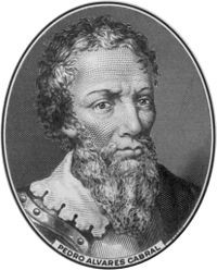 So we may come to the following conclusion: the leader of the expedition wasn’t Cabral at the ocean passage, it was managed by the seaman, who knew that route very well. Otherwise, seamen might meet with difficulties. Because when land isn’t seen for a long time, members of the expedition rise in rebel, demand from admiral and captain to change the course. (the begining of article: “The discover of Brazil was planned in Lisbon”) Best regards, the member of Azerbaijan Geographic Society, President grant holder on literature, laureate of the “Golden pen” award, writer/ investigator Ramiz Daniz email: [email protected],
[email protected] 1 И. П. Магидович, В. И. Магидович. Очерки по истории географических открытий, II том. Москва, “Просвещение”. 1982. стр.54.
 16781 16781 |
|


 |
 |