 AZ
AZ EN
EN RU
RU
VICENTE JANEZ PINSON, DIEGO LEPE OR WHO OFFICIALLY DISCOVERED BRAZIL FOR THE FIRST TIME? - PART IKing Manuel I, who attached special importance to expeditions in the Atlantic Ocean, knew that, leaders of previous expeditions were experienced and skilful navigators and captains. So he couldn’t entrust inexperienced person with the “discovery” of Brazil. The king had two purposes in sending Pedro Cabral’s expedition to the Atlantic Ocean: to send marine under the leadership of the person, who knew the way to the Indian Ocean and to discover Brazil with the help of the seaman who knew certain part of coasts of South America.
What was the reason of such hastiness? Since 1500, Spanish travelers began to leave the Caribbean Sea and explore the territory of the continent located in the south. N. S. Constantinova wrote: “After Portuguese received news that, Pinson approached Brazilian coasts on January 20 and Lepe did it on February 16, additional task also was given to the expedition”. 1 I want to elucidate route of expeditions travelled to Brazilian coasts. Parallels and meridians are the focus of attention. Tordesillas treaty had been concluded and borders had to be fixed. Vicente Janez Pinson (1460-1523): Vicente Janez Pinson, who had won great confidence during the first travel of Christopher Columbus, sailed to coasts of the New World as soon as got patent of the king of Spain and approached the territory located at 80 south latitude – in the south of St. Augustine Cape of South America on January 20, 1500. Then he immediately changed the course towards the north-west and sailed towards today’s Guiana. Vicente Pinson discovered outfall of the Amazon River during that travel (as seamen, who were at 200 km away from the shore, understood that, water of the river is fresh, they called it “Fresh Water Sea”). 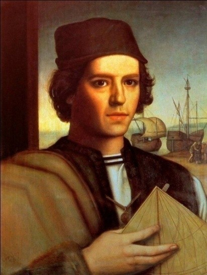 Vicente Janez Pinson (1460-1523)
Diego Lepe (1460-1515): Another Spanish traveler by name Diego Lepe approached unknown land located at 100 south latitude on February 16, 1500 and noted that mentioned land extends towards the south-west. It means that, first of all Brazilian coasts were visited by Vicente Pinson and Diego Lepe, but not Pedro Cabral, so the discovery was made by them. The king of Portugal had spies in ports of Spain and even in the palace of the kingdom, he received information by means of those spies when the Spain discovered new lands. They immediately gave information to Manuel I as soon as the travel of Pinson ended. So the king decided to hurry up. The bull of the Pope Alexander VI had become trouble for Portuguese and Spaniards. Spaniards knew in which side of the demarcation line Big Anthill islands and Small Anthill islands of the Caribbean Sea were situated, but wandered through which part of unexplored lands located in the south of the Caribbean Sea that line passed before Pedro Cabral’s expedition. So it became possible to carry out exploration below the 28th parallel. After Vasco da Gama discovered eastern seaway to India and returned to the motherland, Spanish monarchs annulled monopoly of Columbus in West Hind and issue patent for sending expedition to those territories. 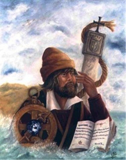 Diego Lepe (1460-1515) Pedro Alonso Nino (1468-1505): One of persons, who got one of first patents, was navigator Pedro Alonso (Peralonso) Nino who had participated at three travels towards the New World coasts and he sailed to the Caribbean Sea with one vessel at the beginning of June, 1499. Nino who respected Tordesillas treaty, organized expedition towards the part of north coasts of South America located in the west. First of all, he wanted to define distance between newly discovered lands and demarcation line. 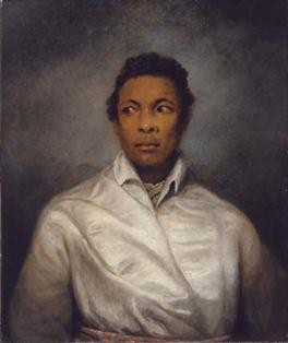 Pedro Alonso Nino (1468-1505) Alonso de Okheda (1468-1505): Alonso de Okheda, who was participant of the second travel of Columbus towards coasts of the New World, got permission for exploring those coasts before Nino and sailed directly towards the continent located in the south of the Caribbean Sea with three vessels. As two vessels had been given him by Florentine bankers, Amerigo Vespucci also participated in the expedition. Besides it, Chuan La Cosa, who had participated in the second expedition of Columbus and other well-known persons had been invited to the expedition. Okheda, who had prepared for the travel perfectly, analyzed the map of the Gulf of Pariah and Pearl Coast sent by Columbus to Spanish monarchs in 1498 before starting the travel. It proves that, he had sailed to coasts of the New World with the special mission. Following fact also proves it: some days after the expedition left the port of Cadis on May 18, 1499 he stopped one caravel on the way and made part of its staff to continue the expedition with him. 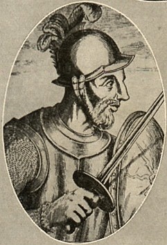 Alonso de Okheda (1468-1505) Amerigo Vespucci (1454-1512): Four vessels approached the coast in Oyapock Bay located at 50 or 60 south latitude and 510 west longitude at the end of June and were divided into two parts. Okheda continued his way towards the west-north-west with two vessels, but Vespucci sailed with the rest of vessels towards the south-west and saw outfalls of two large rivers flowing into the Atlantic Ocean – Amazon in the west and Para in the south on July 2 before Vicente Pinson. They filled barrels with fresh water at 45 km away from the coast. Amerigo Vespucci sailed 100 km towards inwards together with 20 companions in boats, saw that there were dense wood and returned to vessels after two days. Though they continued their way towards the east-south-east on Jule 24, couldn’t overcome more than 250 km because of the current moving from opposite direction. Thus, Spaniards discovered Guiana current which’s speed was 3 km/hour and which was the branch of the South Passat. Several scientists note that, Amerigo Vespucci sailed 1200 km up to Turiasu Bay located at 10 30/ south latitude and 450 west longitude or to San Marcos Bay located at 20 south latitude and 440 west longitude and returned towards the north-west. Vespucci met Okheda near Codera Cape after resting for a while in the island of Trinidad and they came to Spain in June of 1500. Vicente Janez Pinson, who had participated at the first travel of Columbus towards coasts of the New World, left the port of Palos with four vessels bought with money of his relatives on December 1, 1499 and sailed directly towards Brazilian coasts. He changed the course towards the south-west in Green Cape Islands, passed the equator first of all his fellow-countrymen and unexpectedly approached San Roka Cape of Brazil (50 30/ south latitude) on January 26, 1500 after two-day ocean passage. Pinson went ashore together with notary and drove several wooden crosses into the ground. He declared that territory property of Spain kingdom in front of all staff. After this discovery, Vicente Pinson continued his way towards the north-west and the coast disappeared from view after several days. Seamen, who saw that water of the ocean was fresh, began to sail towards the coast. Pinson reached the coast after overcoming 200 km and became the second person, who discovered outfall of Para River after Vespucci. Besides it, he discovered outfall of the largest river of the world after Amerigo Vespucci and called it Mar Dulce (“Fresh Water Sea”) (waters of the ocean were fresh near the continent). Then Pinson sailed towards the north-west and reached coasts of today’s Guiana after Okheda. He explored 3000 km north coast line on his way and discovered 1200 km coast of the new continent. Experienced seaman understood that such coast line might only be specific for continent. But he thought that it was Asia. Thus, Vicente Pinson lost two vessels on the way and came to Palos with remained two vessels on September 29, 1500. 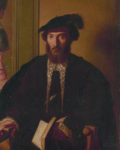 Amerigo Vespucci (1454-1512) Bartolome Roldan: Diego Lepe left the port of Palos with two vessels in the middle of December 1499 two weeks after Pinson started his travel towards coasts of the New World. He sailed towards the south-west together with experienced navigator Bartolome Roldan and approached Brazilian coasts at 50 and 30/ south latitude on February 12. They continued their way towards the south and reached the most outlying point of South America – Saint Augustine Cape (Kabu Branku Cape, 70 south latitude). After sailing 200 km towards the south, they saw that coast extended to the south-west. Just after it Spaniards returned back and repeated Pinson’s route. They entered Amazon, went up for about 400 km and Roldan noted all these facts in his new map. Alonso Velez de Mendoza (? - 1511): They returned to Spain at the end of July of 1500, but after a while Bartolome Roldan was invited to the next expedition to coasts of South America. The leader of that expedition was Alonso Velez de Mendoza – owner of the knight order and bankrupt noble-man. He left Seville with two vessels – “San Cristobal” and “Saint Ghost” (the second vessel was organized by brothers Luis and Anton Gerra) at the end of August and approached the coast at 30-35 km north of Kabu Branku Cape in November. Bartolome Roldan showed himself as a real seaman and professional navigator during that expedition. They continued their way towards the south without wasting any time and saw that the coast line extended to the south-west. Bartolome Roldan reached outfall of the “Deer” River, may be San Francisco River on December 25 and rested there for several days. Vessels continued their way towards the south-west and reached the only large bay located in the north-east of the continent (Todos Santos, Bahia) and Jecitinonia River (160 south latitude) at the beginning of January of 1501. Alonso de Mendoza decided to return back just after it. Though Spaniards couldn’t find valuable stones at that territory, they explored about 1000 km coast line and noted it on prepared map. Both vessels returned to Seville at the end of May and at the beginning of June in 1501. As Spaniards explored territories of Portuguese, results of Alonso de Mendoza’s expedition had to be kept secret. They hoped to annul several paragraphs of Tordesillas treaty. Only after five centuries it became clear that, Bartolome Roldan approached Brazilian coasts before Cabral and could outline that territory. 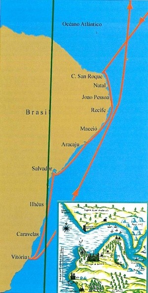 Alonso de Mendoza`s travel The chronology proves that, expeditions sent by Spaniards to Brazilian coasts were organized systematically and the main task was to determine where that coast line extended to. So most of those expeditions were kept secret and their routes were coded. (Continue of article: “First, Spaniards have discovered Brazil”) Best regards, the member of Azerbaijan Geographic Society, President grant holder on literature, laureate of the “Golden pen” award, writer/ investigator Ramiz Daniz email: [email protected], [email protected] 1 Константинова Н. С. Путешествие в прошлое. Навигационная ошибка или секретная миссия?// Латинская Америка, № 5, М.2000, С.8.)
 18884 18884 |
|


 |
 |