
 AZ
AZ EN
EN RU
RU
FERDINAND VAN OLMEN AND THE TRANSATLANTIC PROJECT OF COLUMBUS - PART II (the begining of article: “Some islands on the Atlantic Ocean were known by Muslim scientists”)
All these facts had to be checked. The king Juan II entrusted the Frenchman by name Ferdinand van Olmen known in Portugal as Fernando de Ulmo with realization of this work, he didn’t choose Christopher Columbus for this purpose. Ferdinand van Olmen’s fellow-countrymen had worked as governor in one of Azores. He also was governor of one island before the travel. At that time, most seamen, financers and merchants serving Portugal used to organize expeditions with their own capitals, for example, Cortereal brothers had organized such expeditions in 1500, 1502 and 1506. S. Morison, Charles Verlinden, Vadim Magidovich and Iosif Magidovich noted in their works: “Van Olmen united with a colonialist by name Estreito from Madeira when he organized his expedition. According to words of van Olmen, he wanted to discover several islands located in the west of the Atlantic Ocean or coast of the continent. He called the country he had to discover the “Island of Seven Cities” as didn’t know its name”. Of course, this thought is confusing. Van Olmen had gone to expedition in accordance with the king’s order and he had to check Columbus’s project practically. 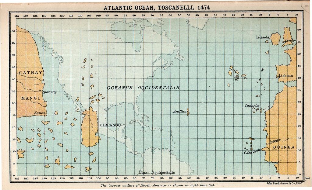 Well-known map of Paolo Toscanelli and real description of the Middle America
Ruling committees of Portugal didn’t pay enough attention to unknown western part of the Atlantic Ocean before Paolo Toscanelli’s well-known map was made. Everybody wandered if there were unknown islands in the west of Canaries, Madeira Islands, Azores and Green Cape Islands. Portuguese organized travels towards the west of mentioned islands in the middle of XV century. In 1462, the king Alfonso V gave great privileges to the person by name Vogado for appropriating about two islands located in the west. The seaman by name Telles searched for Anthelia and the “Island of Seven Cities”. Many seamen travelled after him, but nobody achieved any success. At that time following rumour had spread in Portugal: Islands, which can’t be discovered, are seen from a distance. Of course, it is impossible to believe in such unserious thought. If islands were seen in the ocean, then the king Alfonso V could send there at least one expedition in order to explore those islands. There wasn’t any doubt that, there were islands in the western part of the Atlantic Ocean (near mentioned islands). Columbus also agreed with this thought. But he believed that, there were mythic Anthelia and other islands on the middle of the ocean. The Genoese seaman thought like that because of the letter of Toscanelli. It was possible to use those islands as stopping-places in the ocean passage on the way to Asia. Van Olmen knew results of travels of Vogado and Telles and knew that, it was impossible to use any island as the stopping-place on his way to India through the west, so his expedition would meet with great difficulties. That’s why though Juan II gave permission for organization of the expedition he had doubts about its success. Otherwise he could organize the expedition with his own capital. The king would give many privileges to van Olmen in 1486 if the expedition completed successfully as he had organized the travel on his own account. “Mathematical Union” told the king that, Christopher Columbus had prepared his project owing to Paolo Toscanelli’s calculations. That’s why Olmen had to explore the Atlantic Ocean in accordance with those calculations. May be, the project of the Genoese seaman had been copied when it was in “Mathematical Union” and that copy had been given to van Olmen. Van Olmen started his travel with two caravels in spring of 1487. He planned to pass the Atlantic Ocean in 40 days. I want to mention that, in 1492, Columbus had overcome the distance between Canaries and Bahamas in 36 days. When the Professor Charles Verlinden read the declaration of the French seaman, he noted with surprise that, Portuguese seamen had sent secret expeditions to the west of the Atlantic Ocean before 1486, they knew which islands were on the other side of the ocean and where the unknown continent was situated.1 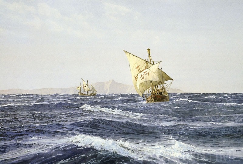 Ferdinand van Olmen in Atlantic Ocean
I don’t agree with this thought of Charles Verlinden. If Ferdinand van Olmen knew the place where unknown islands and large land area were situated, he could easily discover those territories. Besides it, if Portuguese seamen knew the east coast line of the New World, Portuguese could choose the meridian, through which the demarcation line had to pass, when the Pope divided the Earth between two kingdoms in accordance his bull in 1493. But it didn’t happen. As it is known, Portuguese achieved their goals only when Tordesillas was concluded in 1494. If above mentioned assumptions were true, representatives of Juan II might demand to move the demarcation line for 470 liq towards Anthill Mountains discovered by Columbus, but not for 370 liq towards the west from Green Cape Islands. Thus, Portuguese didn’t know that, there was any other island or large land area in the Atlantic Ocean in the west of Canaries, Madeira Islands, Azores and Green Cape Islands. Then how could van Olmen pass the ocean in 40 days? It is obvious that, he reason is different from above mentioned factors. In Portugal Columbus said that, he will pass the Atlantic Ocean in about 30 days in order to reach the eastern coast of Asia. Van Olmen shared this thought with Juan II after he looked through the Genoese seaman’s project. It means that, the French seaman’s expedition travelled in accordance with the transatlantic project prepared by Columbus besides the map made by Paolo Toscanelli. Columbus discusses his transatlantic project
(Continue of article: “Columbus was considered real candidate, who would conquer the Atlantic”) Best regards, the member of Azerbaijan Geographic Society, President grant holder on literature, laureate of the “Golden pen” award, writer/ investigator Ramiz Daniz email: [email protected], [email protected] 1 Чарльз Верлинден, Покорители Америки: Христофор Колумб. “Феникс”, Ростов-на-Дону. 1997 г., стр.23.
 27642 27642 |
|


 |
 |