 AZ
AZ EN
EN RU
RU
THE DISCOVER OF BRAZIL WAS PLANNED IN LISBON - PART II (Continue of article: “Adventure of the Portuguese marine travelling to India in the Atlantic Ocean”)
The distance between San Nicolas Island and Corumba Cape (together with obstacles occurred in the ocean at the result of currents) is about 4000 km. Vessels sailed only with the south course. The distance was 1600 km at the latitude of Corumba Cape. It isn’t convincing that, vessels lost their way at that latitude and sailed towards the west. Navigators had to understand such mistake. They had compass for manoeuvring in the ocean and determining orientation. It is absurd to lose way when the compass is available. But it was possible from certain point of view at that time. It is possible to dodge from the fixed course when the weather is so foggy or windy, but this deviation may be 300-400 km or 500-700 km when storm is so heavy. According to diaries of the expedition, Portuguese didn’t meet any serious natural calamity before passing the equator. It means that, it was impossible to lose way as the weather was good. So Portuguese hadn’t lost their way, they changed the course purposely and sailed to Brazilian coasts with fixed course and discovered mentioned lands. Marine of experienced navigators couldn’t lose its way in the ocean for 1600 km. 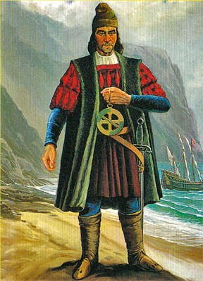 Bartolommeo Dias (1450-1500) Experienced captains and commanders as Bartolommeo Dias, Diego Dias, and Duarte Pacheco Pereira were participants of the expedition, these seamen noted the distance they had overcome on their diaries every day and controlled the course of vessels. So they had to understand that the expedition had dodged from the main course and warn Pedro Cabral. But it seems that, the leader of the expedition was satisfied with this deviation and he entrusted his assistants with the course at the ocean passage. In spite of it, the expedition dodged from the main course and sailed in other direction for a long time. But it isn’t convincing argument. It’s necessary to analyze one important fact. The expedition lost its way in several days after moving away from Green Cape Islands. But Portuguese changed the course towards the Cape of Good Hope located in the south of Africa after leaving “Vera-Crush” “discovered” on May 2. Though they sailed 8000 km, didn’t lose their way and reached the island soon. It means that, Portuguese navigators, who were very skilful in maneuvering in the open ocean, couldn’t reach Brazilian coasts by dodging from the main course when sailed from Green Cape Islands to the Cape of Good Hope. If it happened – if the expedition lost its way and reached Brazilian coasts, it would lose its way when sailed to the Cape of Good Hope as Portuguese sea travelers used that route for the first time. As it is known, Portuguese met with heavy storm when reached the south of Africa and lost four vessels together with their staffs. It should be especially noted that, Bartolommeo Dias, who had taken the expedition to the south of the Cape of Good Hope, also was the victim of that storm. 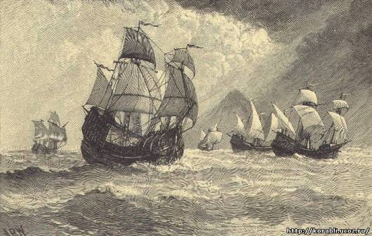 The expedition of Pedro Cabral is sailing towards the south of Africa
It should be noted that, it is possible to determine the geographical latitude continuously when the weather is enough good. How Portuguese could lose the way in that case? Besides it, Pedro Cabral didn’t punish any of his navigators or captains after understanding that the expedition is on the other side of the Atlantic Ocean. Nevertheless such mistake shouldn’t be forgiven at that time. Seamen were surprised. They knew that all tasks of their captains had been fulfilled professionally. They began to explore the coast as soon as the land was seen. Besides it, Portuguese put big wooden cross on the coast instead of the stone emblem indicating that mentioned territory belonged to the Portugal Kingdom. What it was? It was next negligence or discovered lands weren’t so significant? Nevertheless every sea traveler had to approach such discovery seriously as Portuguese searched for lands on that part of the Atlantic Ocean for tens of years and couldn’t achieve any success. Though Cabral achieved this “happiness”, he was indifferent to his “discovery”. 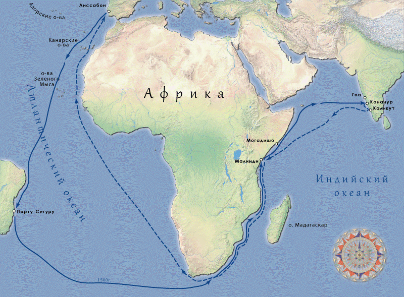 The transport of Cabral`s expedition
Why the expedition, which travelled from Lisbon to Calicut, chose strange course? Did Pedro Cabral know that other route had been chosen? Apparently, knew. That’s why such negligence had to be punished by him. If that discovery wasn’t important for Portuguese, why did Cabral send one of vessels, which had to sail to India to Lisbon in order to give information about the discovery? It is known that, ten days after the discovery of Brazil the leader of the expedition sent Gaspar de Lemos to Portugal with his vessel and the letter he had written. Information about the discovery was usually sent hastily when discovered geographical point had special importance. It means that, the discovery of Brazil had been planned beforehand and the world community had to be informed about it. But who had to take the marine to Brazilian coasts, Bartolommeo Dias, who knew half of the way or other person who knew that route very well? Best regards, the member of Azerbaijan Geographic Society, President grant holder on literature, laureate of the “Golden pen” award, writer/ investigator Ramiz Daniz email: [email protected], [email protected]  24470 24470 |
|


 |
 |